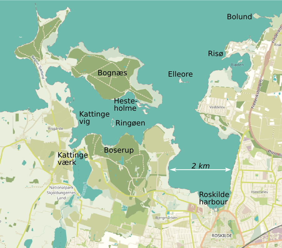
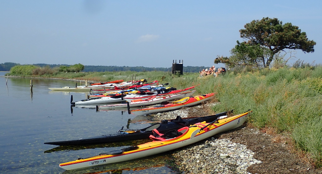
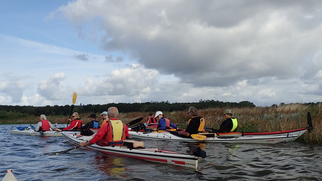
Within a day paddle from Roskilde harbour is a semi-natural area of meadows, woodlands and islands of great charm and variety, though without rocky drama.
Leaving the jetty of the sailing club is occasionally impeded by the only biggish ship on the Fjord, a sailing restaurant.
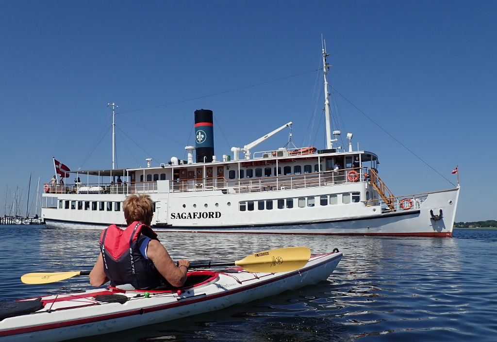
Otherwise there has not been much traffic for centuries, ever since ships got deeper than the 2 metres of reliable water depth through the 40 km long fjord.
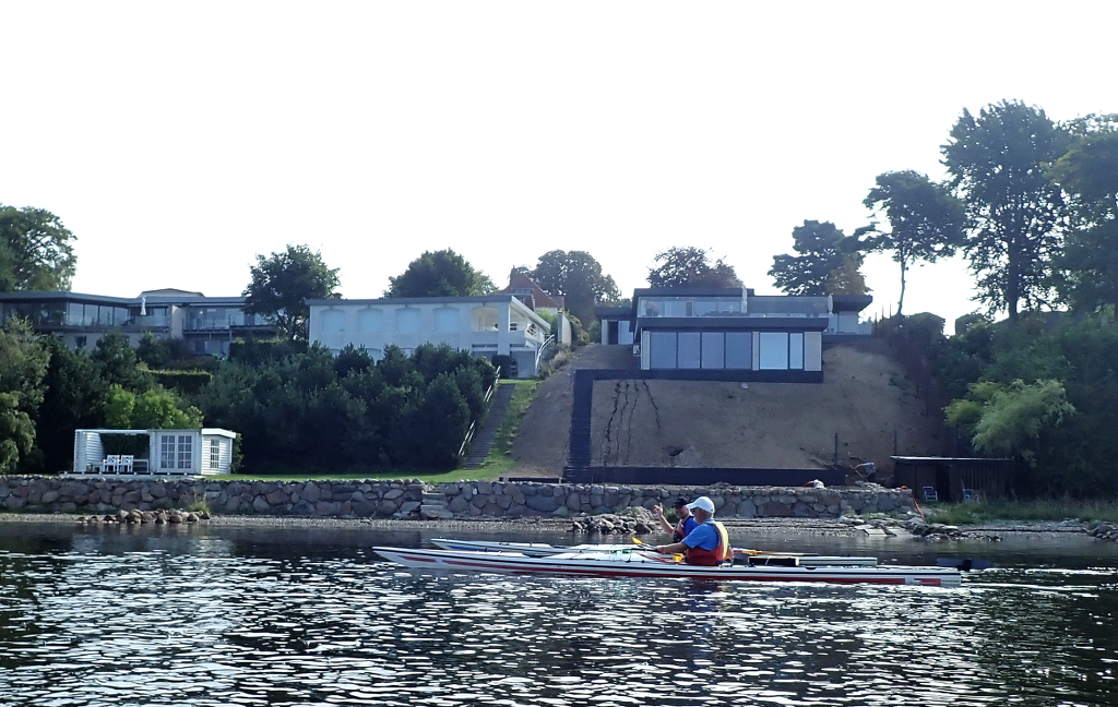
The urban fringe is a line of expensive houses on the road leading north from Roskilde. There is strong re-building activity in Roskilde, which is a satellite town to booming Copenhagen, 35 km to the east.
The east side of the fjord is quite steep in parts, which makes a newly seeded slope vulnerable to torrential rain after a long drought.
Continuing northwards we pass Roskilde’s official bathing beach and campsite and then come to the self-proclaimed kingdom of Elleore (founded 1945), a tiny island with no permanent occupants but furnished with a quixotic sub-set of the attributes of an independent nation, but evidently no border guard to check our visas.
There is one tree on the island, a few scrubby bushes, concrete blocks from the second word war and a mysterious tower with a fine wrought iron ladder leading to an absent roof.
Paddling on northward one passes the cylindrical reactor building of the Risø nuclear research establishment, disused since the 1950s. The energy production priority has changed to wind power, with a multi-rotor turbine tower.
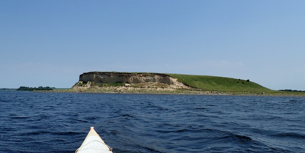
At the very top of the map is the mysterious plateau, Bolund, 12 m high. It is a piece of moraine from the ice age.
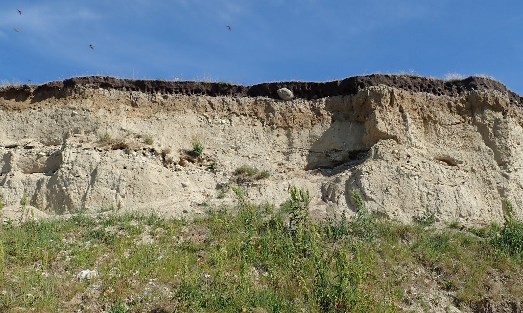
It has a varied flora and a colony of sand martins which nest in the softer strata of the moraine, which also has extremely hard parts in the form of huge stone blocks ready to fall out at any time.
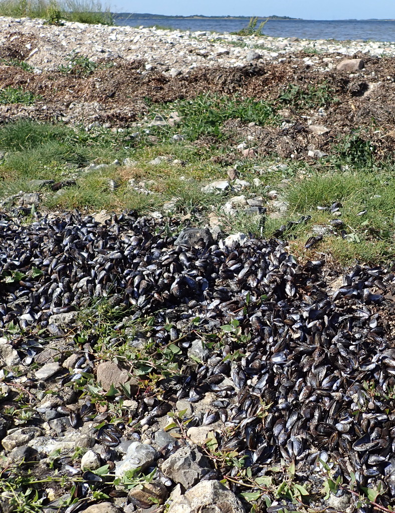
Bolund is connected to land by a narrow neck, which is sometimes submerged.

This has a regular stratification with long strips of dried sea grass and blue mussel shells.
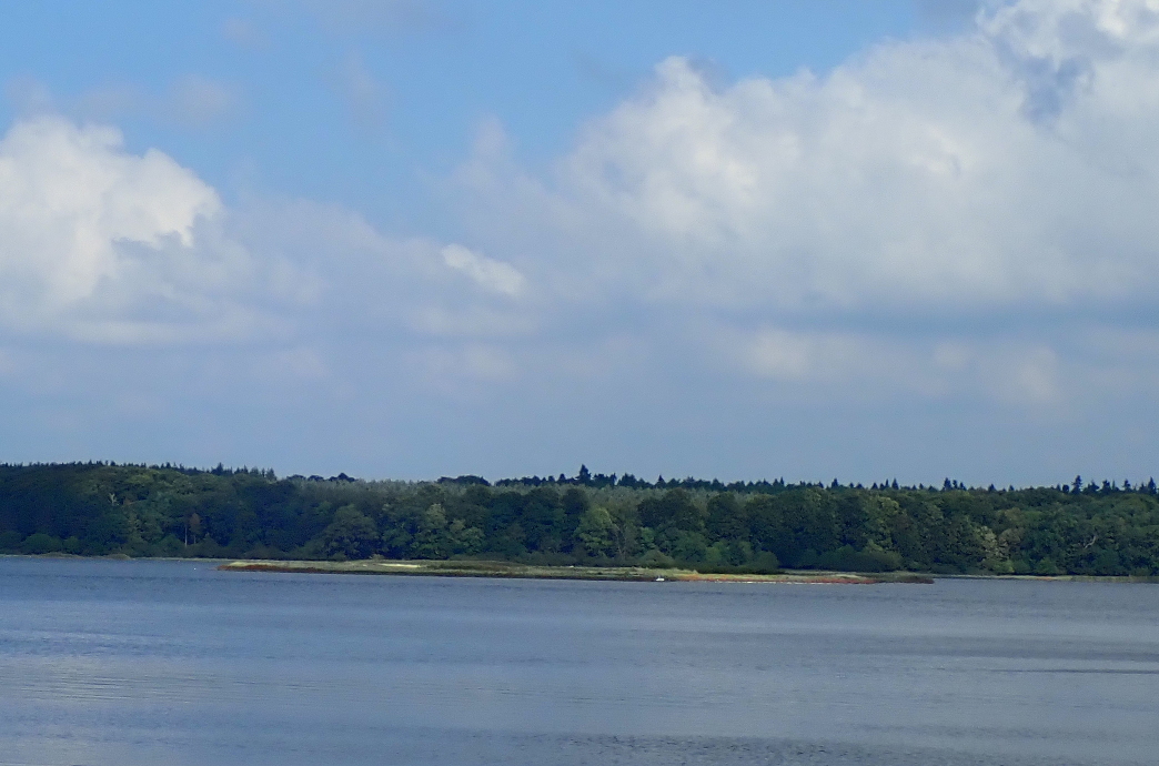
On the west side of the fjord is the wooded peninsular called Bognæs. It is accessible to walkers, cyclists, and of course paddlers, as is nearly all Danish woodland.

Moving south now, one comes to a group of very low lying islands called Hesteholme. Even a kayak cannot sneak between them at low water.
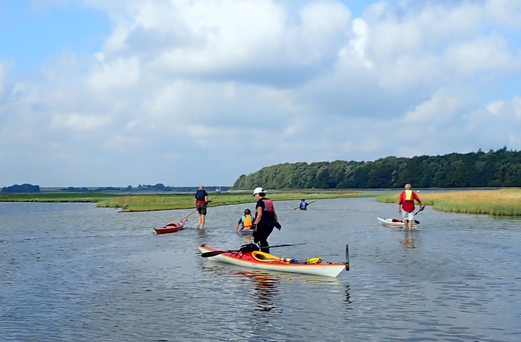
The water level in the Fjord rarely strays more than half a metre from its average level, but this allows exploration of some places which are often inaccessible.
Between Bognæs, in the distance, and Boserup is the strange ring of gravel called Ringøen. Its lagoon can be visited when the water is high, and when birds are not nesting there.

The passage into the lagoon is only a paddle length wide. Within, the water is shallow and good for a short pause from the 6 m/s wind blowing outside.
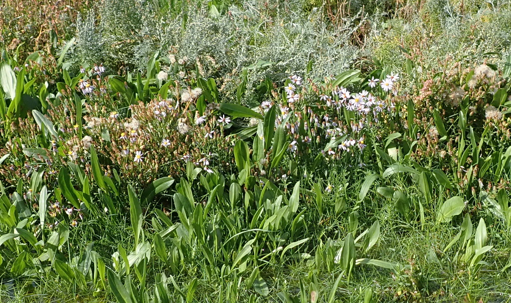
The abundant fertiliser from the birds supports a rich flora, here one of the last seashore flowers of summer, the Sea Aster (or a related species).
There is said to be a spring within the lagoon, which ensures that water is always moving out from the lagoon, but no-one has found it and I suspect reporting bias: it is easier to pass by the outside of the island than to land and tramp over to check the flow into the lagoon. Anyway, it should be easy to check with modern sensors and the internet of things.
Boserup wood is relatively ancient, surviving through the chance of ownership and is now a public park with primitive camping huts.

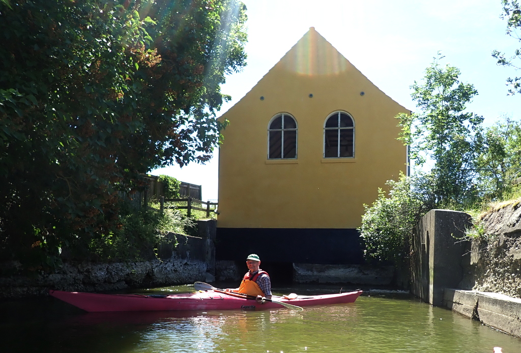
Further west one reaches Kattinge works, a water mill fed by damming a portion of the fjord to make a big lake. The dam is from the 14th c. but the water mill was first established here in the 18th c. The present building is 19th c., I suspect. It stopped working as a mill in 1910 and now serves as one wall of a concrete fish ladder, aesthetically brutal but good for wildlife and fishing people.
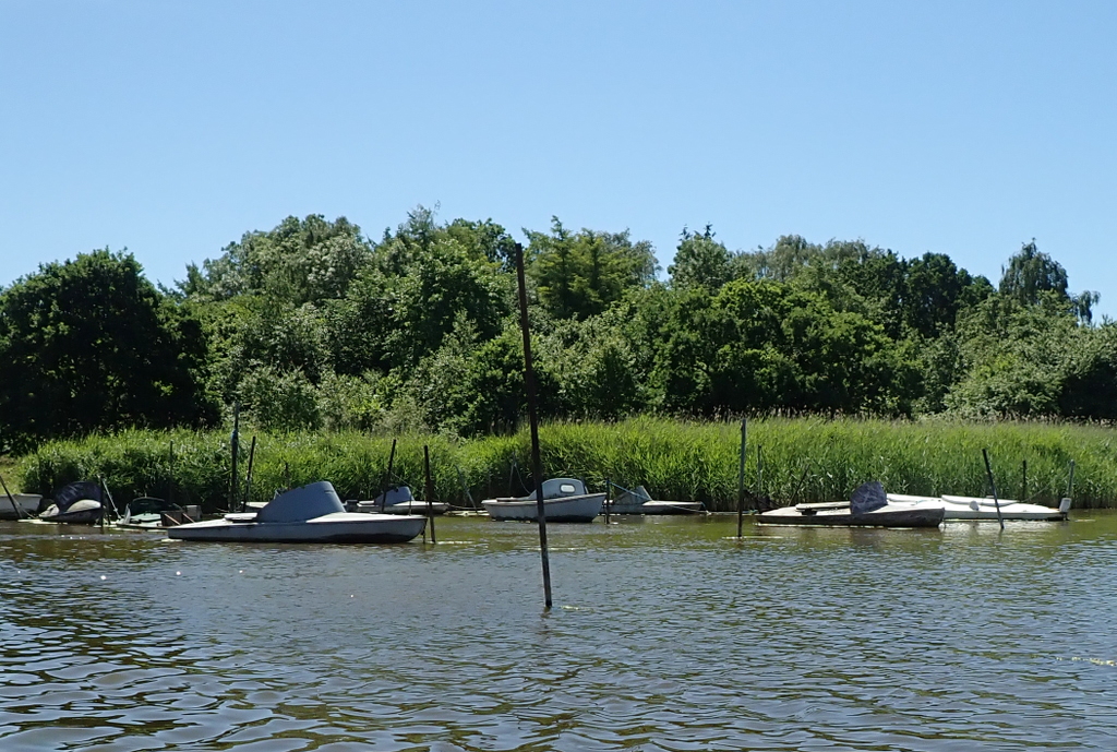
A present day activity is shooting ducks. Here is the boat yard for the camouflaged shooting punts.
Apart from risking a shower of tungsten pellets in the shooting season, the main hazard on the fjord is the abundance of stones hiding just below the surface. So far, my canvas kayak has proved resilient.
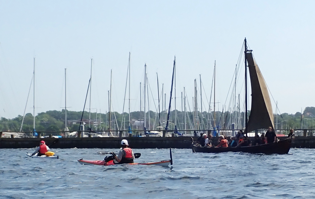
Returning to harbour one meets another form of water traffic – the replica Viking boats with woolen sail spread to the wind.
tim, 2018-09-22